
A powerful kona low sitting northwest of the Hawaiian Islands is driving a Winter Storm Warning across Hawaii’s Big Island summits above 12,000 feet, with the National Weather Service in Honolulu keeping the warning in effect through 6pm HST Saturday.
The Setup
Kona lows are slow-moving, cut-off low pressure systems that periodically develop near the Hawaiian Islands, typically in winter and spring. Unlike typical Pacific storms that track from west to east, kona lows stall and churn, allowing them to wring out prolonged periods of heavy precipitation. When they’re strong enough and positioned correctly, they can drive significant snowfall to the highest elevations in the state.
What to Expect
The NWS is forecasting 12 to 18 inches of total snow accumulation on the upper slopes of Mauna Kea and Mauna Loa, with wind gusts potentially reaching 110 mph. Blizzard conditions are possible, with blowing snow dropping visibility to near zero at times. The combination of extreme winds and heavy snow will make travel to the summits very difficult to impossible through Saturday evening.
Who Is Affected
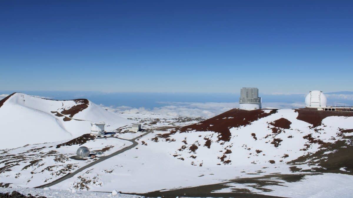
The warning covers Hawaii’s Big Island summits of Mauna Kea and Mauna Loa above 12,000 feet. That includes access roads to the Mauna Kea Observatories and the Mauna Kea Visitor Information Station, which sits at around 9,200 feet and could see deteriorating conditions as well.
What You Should Do
The NWS is urging anyone with plans to visit the summits to postpone until the threat diminishes after Saturday. Do not attempt summit access during the warning period. Conditions can change rapidly at elevation, and zero-visibility blizzard conditions with hurricane-force gusts leave no margin for error. Check weather.gov/hfo for updates before any travel to upper elevations.
The warning remains in effect until 6pm HST Saturday.