
It’s no secret that this winter has been pretty lackluster for snowfall in the western United States, and while some areas are finally starting to see major snowfall, it’s still mostly a long way away from average.
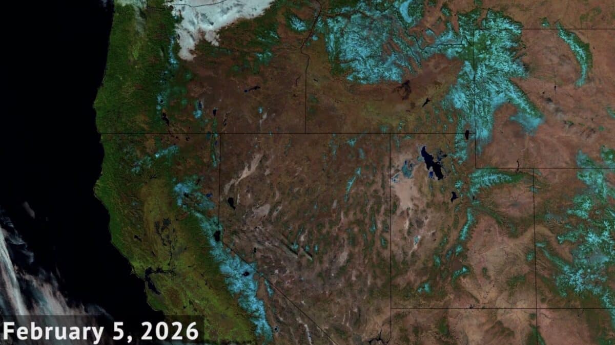
The National Oceanic and Atmospheric Administration released a timelapse comparing mid-winter snowpacks over the past 13 years. Enhanced color imagery from the Joint Polar Satellite System makes it much easier to see the difference, coloring the snowpack in cyan.
This #TimelapseTuesday, we're looking at changes in midwinter snowpack across the western United States over the past 13 years. This enhanced color imagery, from @NOAA's @JPSSprogram satellites, shows snowpack in cyan. pic.twitter.com/7I7GUK1B0b
— NOAA Satellites (@NOAASatellites) March 10, 2026
It’s a pretty wild timelapse to watch. Some years look bad while some look good, but you can’t really comprehend just how bad 2026 looks until you see the satellite image. That image was taken back on February 5th, so the snowpack has obviously changed since then, but it’s dramatic when comparing it to years before and years past.
Fingers crossed the snow keeps coming down into the early spring. And hopefully next year will look quite a bit different.