
Amazing news for all you Palisades Tahoe skiers and snowboarders as the Lake Tahoe resort cashed in big from a holiday storm system that deposited some much needed accumulation in the midst of an underwhelming start of the season. Resort officials are reporting the storm has pushed upper mountain totals toward 3 feet so far with another 24–40 inches in the forecast.
“Moments like this remind us why we do what we do. From the first storm cycle to the first lift spinning, there’s a shared energy that connects our community to these legendary peaks. As winter settles in, we’re grateful to be part of something bigger: a deep love for the mountains, the sport, and the experiences we share out here together.”
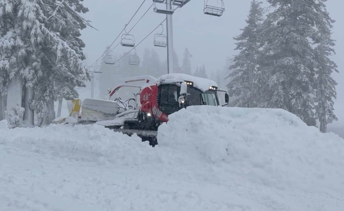
Great to see one of our favorite resorts getting what the describe as a “Christmas Miracle.” Read the full conditions report and forecast for the week below.
Snowfall Report:
Another wave of heavier snowfall moved through Thursday night after the lull that we had expected Thursday afternoon. Most of the snowfall reported this morning fell overnight. Mountain ops is reporting an additional 21 inches up top in the past 24 hours on the upper mountain, and 9 inches at the base.
That brings the 2-day storm total to 16 inches at the base, and 50 inches up top so far! The 7-day total up top is 64 inches, or just over 5 feet and counting!
Friday Snow Showers:
Snow showers continue around the northern Sierra on Friday morning. We will see a final round of some steadier snow Friday afternoon-evening as the center of the low-pressure system off the coast, responsible for the snow over the last few days, finally moves inland. Here is a look at our Forecast Radar map layer for Friday.
Highs near freezing again at the base and 20s up on the mountain. The latest model runs show the gusty winds hanging around a bit longer through the day on Friday, with ridgetop gusts from the SW up to 60-70+ mph at times.
A final frosting on top of all of the snow that fell this week, as powdery snow will fall up on the mountain, with up to several inches of final accumulation. We will tally up the storm totals on Saturday morning.
Drier Pattern:
High pressure begins to build in over the region over the weekend, and will be pretty strong by Tuesday.
We will see mostly sunny skies each day, along with lighter winds starting on Saturday. It stays cold for the weekend with highs in the 30s for the lower elevations and 20s for the higher elevations. Then warming into the 40s for the lower elevations next week. The dry pattern is expected to last through at least New Year’s Eve.
More Storms Possible:
The long-range models continue to show the ridge weakening and shifting east by the 1st, with a trough digging into the West Coast, opening the door back up to storms, but wet or weak storms?
The next storm is still showing up between the 1st – 2nd of January on the forecast models. They are also still showing the chance for moisture from a low south of CA next week to get drawn north into the Sierra by the 1st, but some models keep it south, with just a weaker storm from the NW on the 2nd-3rd.
That scenario would bring us a chance for some lighter snow around next Friday – Saturday. The forecast models drawing moisture north on the 1st ahead of the system on the 2nd, not only bring in additional precipitation on the 1st, but make the system on the 2nd wetter as well.
The wetter forecast would unfortunately also come with higher snow levels, so the better outcome for us could be a weaker storm. We will be tracking these storm systems all week, as this will be our next chance for snow after the current storm clears the region on Saturday.
Long-Range Outlook:
As I mentioned above, some models keep the trough over the region with the chance of additional weak systems through about the 6th/7th of January. Others show high pressure building in over the region faster, with no more storms beyond the 3rd. We’ll be watching the trends on that as well.
No matter how fast, they all show high pressure building in over the region during the 2nd week of January, bringing us a drier pattern again. For the West Coast, this could be more of a typical weak La Niña pattern, with the storm track staying up in western Canada and the Pacific NW.
Hopefully, that changes, and we can find more big snowstorms as we go into January.