

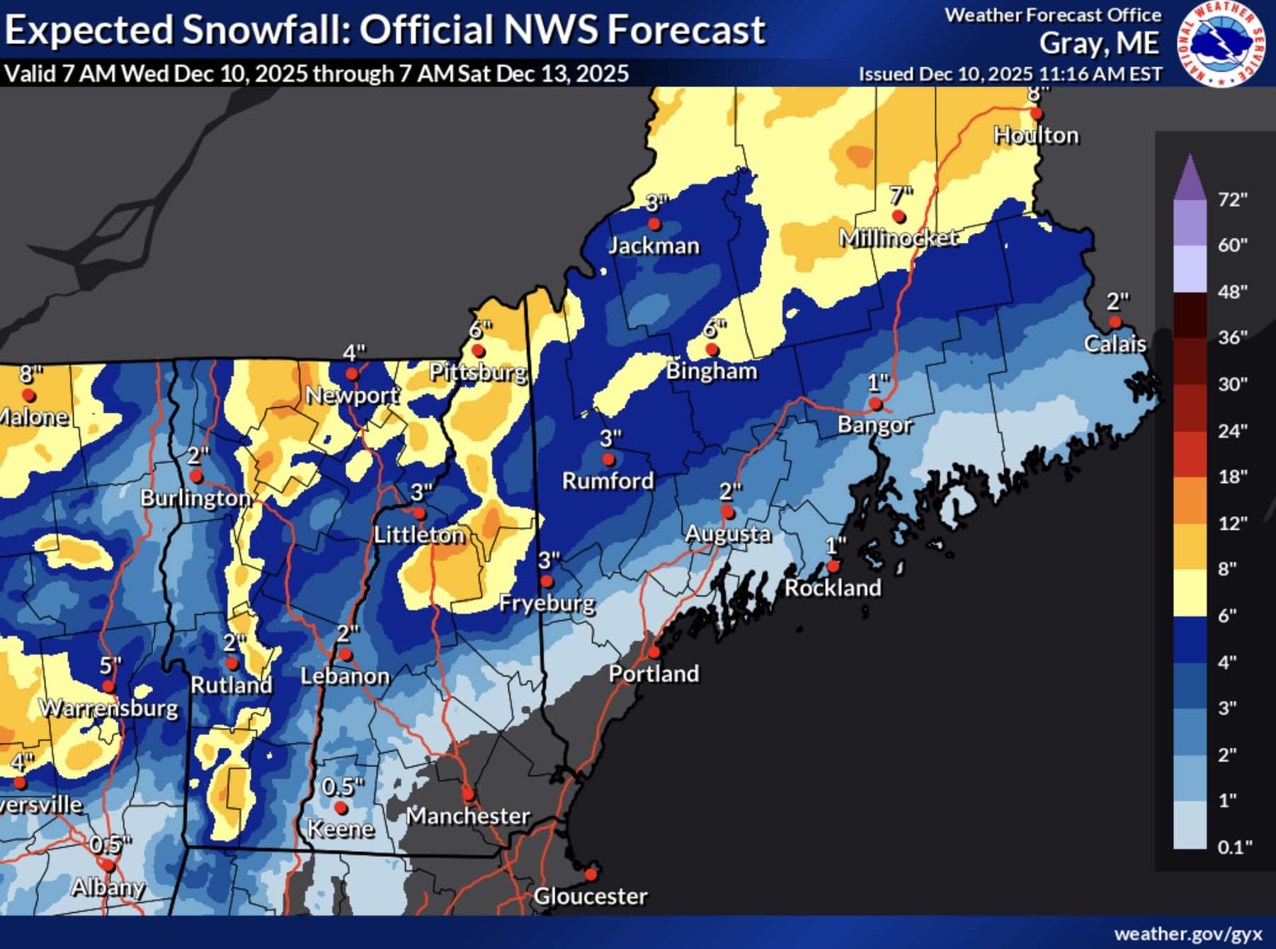
Residents across northern New York, Vermont, New Hampshire, and Maine should prepare for accumulating snowfall today through Thursday morning, with the National Weather Service posting Winter Weather Advisories for multiple regions forecasting accumulations up to 7 inches of snow.
Winter Weather Advisory: Northern New York

The northern tier of New York, including areas around Massena, Malone, Lake Placid, Saranac Lake, and Ogdensburg, is expected to receive significant snowfall from this winter system. Snow accumulations between 3 and 7 inches are forecast through Thursday morning, with the heaviest snow expected between 10 AM and 4 PM Wednesday.
Blowing snow will be a factor across the region, further reducing visibility and creating hazardous travel conditions. The National Weather Service warns that the Wednesday evening commute will be particularly impacted by the storm.
Winter Weather Advisory: Vermont
Multiple counties across Vermont will also see substantial snowfall from this winter storm. Areas including Stowe, Montpelier, St. Johnsbury, and Rutland are forecast to receive between 3 and 7 inches of snow, with the advisory extending from 7 AM Wednesday to 1 AM EST Thursday.
The heaviest snow is expected during the afternoon hours on Wednesday, with snowfall continuing into Thursday. Roads and bridges will likely become slick and hazardous throughout the day.
Winter Weather Advisory: New Hampshire And Maine
Western Maine and northern New Hampshire will experience additional snow accumulations between 2 and 4 inches, bringing storm totals to 4 to 6 inches in most areas. Some locations in southern regions may see mixed precipitation, including snow and freezing rain.
Even light snowfall amounts can accumulate quickly on roads and create dangerous driving conditions. The National Weather Service emphasizes that the Wednesday evening commute will be impacted across the region.