
Major Pattern Flip: Winter Is About to Hit Fast and Hard
The 2025 Thanksgiving weather forecast indicates that after weeks of unusually mild fall weather across much of the eastern half of the country, the models have done a dramatic U-turn. Starting Thanksgiving Day, a series of Arctic cold fronts will plunge temperatures well below normal from the Plains to the East Coast, with multiple rounds of reinforcement arriving through the first week of December. The days of complaining about “no winter” are officially numbered.
Video and Forecast By Direct Weather
Thanksgiving & Black Friday Cooldown (Nov 27–28) A strong upper-level trough digs into the central and eastern U.S., dragging much colder air southward. Highs in the 30s and lows in the teens to 20s will feel like a shock after recent 60s and 70s. Lake-effect snow machines turn on in full force downwind of the Great Lakes, with several inches possible from western Michigan through western New York and northwest Pennsylvania by Black Friday.
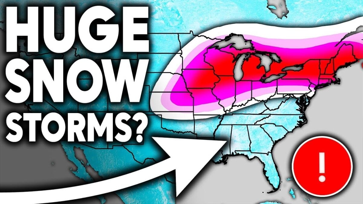
First Big Snow Threat: Nov 29 – Dec 1 A developing storm in the central Plains lifts northeastward late this weekend into early next week. Current guidance shows the potential for a significant accumulating snow event across parts of Missouri, Illinois, Indiana, Ohio, Lower Michigan, and possibly into western/central Pennsylvania. Amounts could reach 6–12+ inches in the best bands, though the rain-snow line remains the big wildcard. A slight northward jog (very possible) would push heavier snow into Wisconsin and northern Lower Michigan while sparing areas farther south.
Second & Third Waves: Dec 2–9 Behind the weekend system, cold air reloads quickly. Additional quick-moving clippers and a potentially stronger coastal low around Dec 4–6 could deliver more snow to the Ohio Valley, interior Mid-Atlantic, and southern New England. Even the normally warmer GFS model is now showing repeated eastern snow chances—something it resisted just days ago.
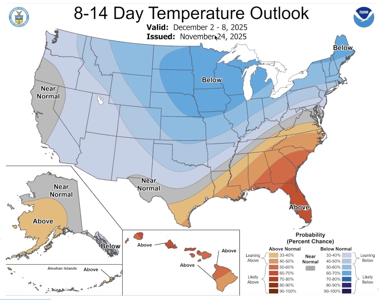
Temperature Outlook European and GFS ensembles agree: the northern two-thirds of the central and eastern U.S. will average colder than normal from Nov 27 through at least Dec 7. The stubborn Southeast ridge will try to fight back with brief warm-ups (especially near the Gulf Coast), but it keeps getting beaten down by fresh Arctic plunges.
Bottom Line for the Next 10–14 Days
- Primary snow jackpot zone: northern/central Plains → Midwest → Great Lakes → Ohio Valley
- Growing interior Mid-Atlantic & Northeast potential if the ridge continues weakening
- Coastal areas and I-95 corridor will flirt with rain/snow mix events but need perfect timing for big accumulations
Enjoy the mild air the next 48 hours—it’s the last taste of autumn for a while. Winter is finally showing up, and it looks like it plans to stay active straight into December. Stay tuned; details will shift daily, but the overall colder, snowier pattern is now locked in across both major models and their ensembles.