

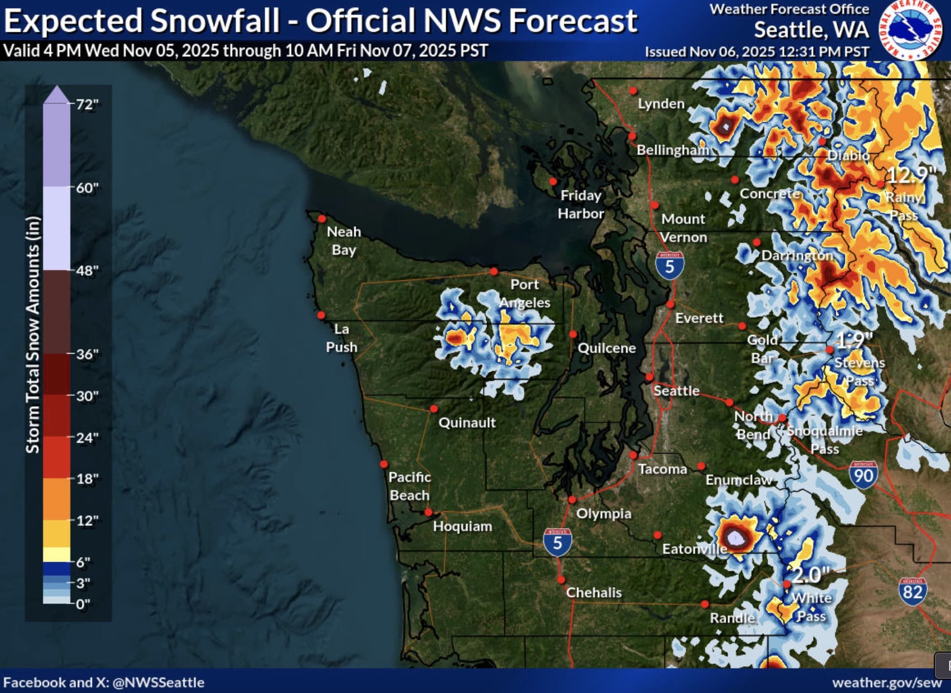
Washington skiers and snowboarders can rejoice in knowing that a ton of snow is continuing to fall on several of the state’s northern mountains, with a foot or more expected throughout the northern portion of the state. A Winter Storm Warning for the region remains in effect until 10am PST on Friday, November 7th.
Winter Storm Warning
A winter storm warning is in effect for the Cascades of Whatcom and Skagit Counties and the area around Washington Pass in Western Okanogan County. Heavy snow is expected throughout the regions, with 8 to 10 inches of snow accumulation possible along Highway 20 near Rainy Pass and up to two feet possible on Mt. Baker.
Around Washington Pass, heavy snow is anticipated above 4,000 feet, with additional snow accumulations of 7 to 15 inches possible. The highest totals will fall near the crest above 5,000 feet, including Washington Pass.
In some areas, winds could gust as high as 35mph. Travel at the high elevations of the North Cascades, including Highway 20 across Rainy and Washington Pass, could be very difficult to impossible. The National Weather Service recommends keeping an extra flashlight, food, and water in your vehicle in case of an emergency if you must travel. Travel information for the state of Washington is available here.