

The winter of 2025-2026 is shaping up to be memorable across the United States, with factors aligning for intense activity. Meteorologist Max Velocity explains that a strong polar vortex and ENSO-neutral pattern leaning toward La Niña will drive this, echoing the harsh 2013-2014 season. Frequent storms will bring heavy snowfall, damaging ice, and severe cold, as arctic air collides with moist subtropical flows, causing disruptions like record wind chills and power outages.
Typical U.S. winters tend to vary. The Gulf Coast, Deep South, southwestern deserts, and Pacific coasts see little or no snow, needing rare polar pushes for 1-2 events every few years. The Southern Plains, Mid-South, Mid-Atlantic, and Pacific Northwest average 12-24 inches, with storms most years. The Midwest, northern plains, and Northeast get 24-36 inches or more, while New England, the Great Lakes, and the Rockies often exceed 4 fee, reaching up to 70-100 inches in extremes, with single storms dumping over 24 inches alone.
2025-2026 Winter Snowfall Forecast?
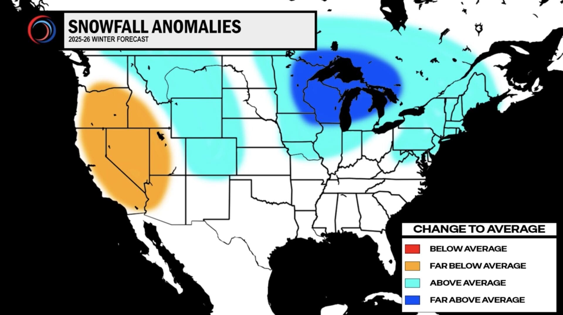
This season favors above-average snow in many areas due to persistent cold. The North Central U.S., Rockies, Midwest, Ohio Valley, and Northeast could expect a longer season with 6-12 inches extra, from frequent big storms and possible nor’easters.
Upper Midwest and Great Lakes could see 12-24 inches above normal, with moisture and cold fueling events over 18 inches each.
The West differs. Areas west of the Sierra Nevada may get zero solid snowstorms, down from the usual 1-2. Sierra Nevada faces 24-36 inches below average, while the Southern Plains, Deep South, and Ohio Valley are wildcards, potentially 1-2 big storms or quiet, per European models through May 2026.
2025-2026 Ice Forecast
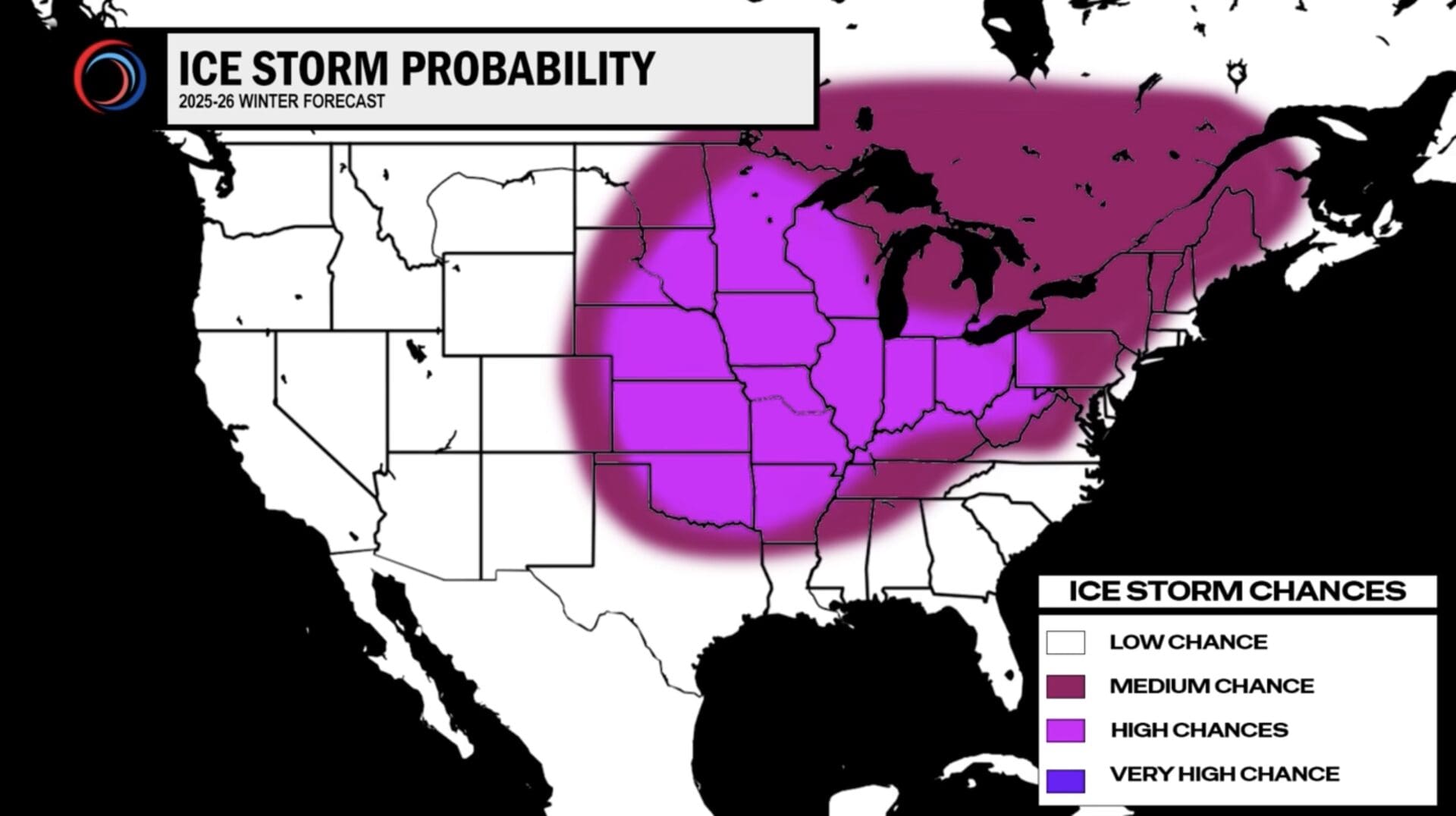
Ice storms will intensify threats, more frequent from Rockies to East Coast, with up to 0.5 inches of freezing rain potentailly halting travel and causing outages.
The Ohio Valley, Midwest (like Chicago and Minneapolis), and areas south to Oklahoma and Arkansas could anticipate multiple events, including 1-2 major ice storms. Iowa, Missouri, Kansas, and Nebraska have the highest confidence for 1-2 massive storms.
The polar vortex channels arctic blasts to northern plains and Upper Midwest, with wind chills to -60°F or -70°F. Below-average temps may reach Alabama, Mississippi, and Georgia. La Niña pushes the polar jet south, sparking storms like 2013-2014’s ice havoc, record cold, and surplus snow.