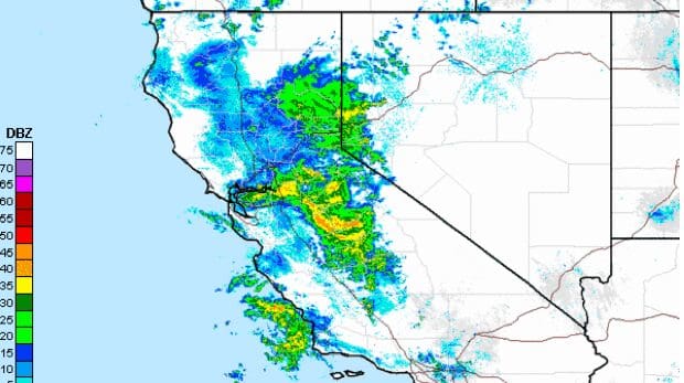
The storm is still on track to nail us tonight and tomorrow. It’s spinning that red and orange you see in the picture above straight towards us with a classic winter-esque SouthWest wind. A few of us are in position for an assault of the June Powder tomorrow morning and Monday. Although, it’s only 45F in Truckee right now at 11:11pm on June 5th, 2011. Stay tuned...
Noaa.gov’s Winter Weather Advisory:
THE WINTER WEATHER ADVISORY IS NOW IN EFFECT FROM MIDNIGHT
TONIGHT TO 5 PM PDT MONDAY.

* SNOW ACCUMULATIONS: 4 TO 5 INCHES OF ACCUMULATION EXPECTED
  WITH LOCALLY HIGHER AMOUNTS ABOVE 7500 FEET.

* ELEVATION: ABOVE 6500 FEET. SNOW LEVELS WILL INITIALLY BE AROUND
  7000-7500 FEET THEN LOWER TO NEAR 6500 FEET BY EARLY MONDAY
  MORNING.
Noaa.gov’s Daily Predictions for 7,400 feet in Tahoe:
Sunday Night – 3-5 inches
Monday – 3-5 inches
Yep, it’s crazy, but it’s not bad for a quaint little June snow stormage. Not bad at all.


