
A Winter Storm Warning is currently in effect from Sun Valley to Grand Targhee reports NOAA and it appears as though Idaho is about to see their first monstrous snowfall of the season.
Related: The Pineapple Express Is Coming! | Western USA To See Bigtime Snowfall Totals By Monday
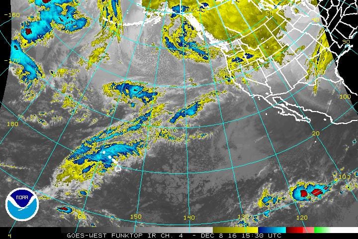
The storm is a just a small portion of a larger atmospheric river event that will impact the western USA this weekend, delivering feet upon feet of snowfall to the higher elevations of the northern rockies.

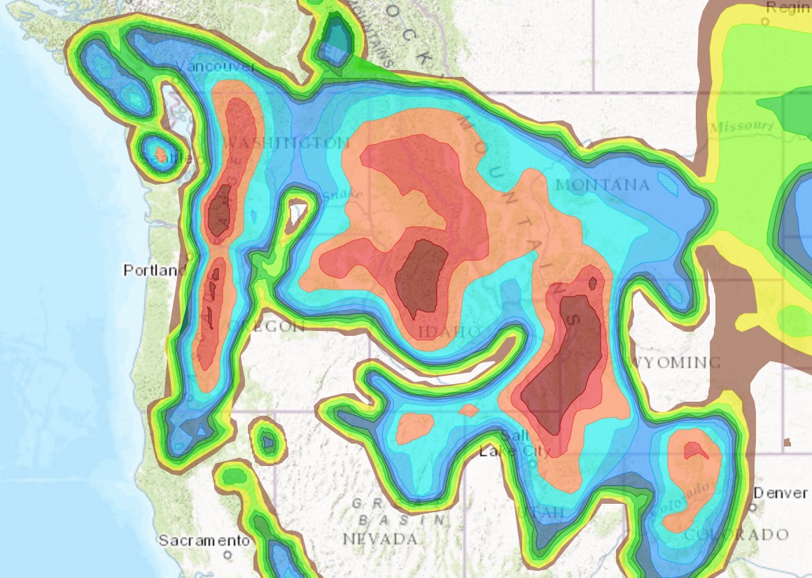
Forecasted Snowfall Totals
- Grand Targhee – 34″(Wyoming…)
- Brundage – 25″
- Pebble Creek – 24″
- Sun Valley – 20″
- Schweitzer – 14″
- Tamarack – 12″

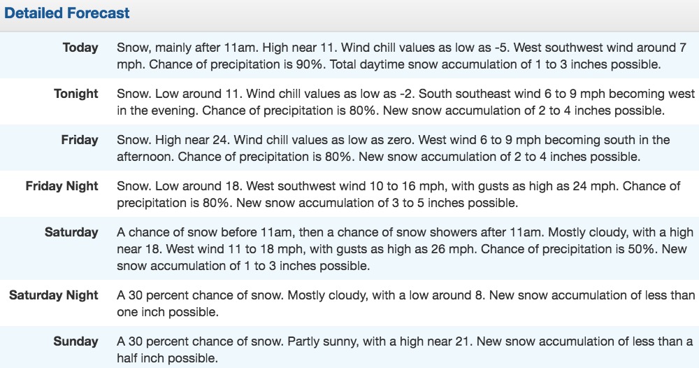
Winter Storm Watch
…WINTER STORM WARNING IN EFFECT FROM 11 AM THIS MORNING TO 5 PM MST SATURDAY…
THE NATIONAL WEATHER SERVICE IN POCATELLO HAS ISSUED A WINTER STORM WARNING FOR SNOW…WHICH IS IN EFFECT FROM 11 AM THIS MORNING TO 5 PM MST SATURDAY. THE WINTER STORM WATCH IS NO LONGER IN EFFECT.
* IMPACTS…MODERATE TO HEAVY SNOWFALL WILL ACCUMULATE ON ROADWAYS RESULTING IN SLICK SURFACES AND REDUCED VISIBILITY.
* TIMING…STARTING THURSDAY AFTERNOON THROUGH SATURDAY
* SNOW ACCUMULATIONS…6 TO 10 INCHES THURSDAY AND FRIDAY ABOVE 7000 FT…AND ANOTHER 10 TO 15 INCHES FRIDAY NIGHT AND SATURDAY.
* LOCATIONS…STANLEY…CLAYTON…ST. ANTHONY… ASHTON… ISLAND PARK… DRIGGS… VICTOR… MALAD CITY… OAKLEY… ROCKLAND… HENRY… SODA SPRINGS… DOWNEY… LAVA HOT SPRINGS… PRESTON… MONTPELIER… HAILEY… KETCHUM… BELLEVUE… ARCO… CHALLIS… MACKAY