
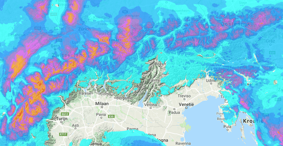

[Forecast courtesy of wePowder]
A retour d’est– there’s just nothing as magical in the alps. Anyone who was drinking espresso in the far south of the Piedmont on Wednesday morning probably would have wondered whether the announced snow was still coming.
But those who looked again 24 hours later probably did a double take. A retour d’est brought 60 cm of fresh snow in less than 24 hours. It remains a bizarre phenomenon. It was snowing on the beaches of the Mediterranean. As mentioned yesterday, only the most southern part of the Piedmont got significant snow. The low pressure area was slightly situated too far south to bring snow to the western or northern Piedmont.
There was enough snow coming down to announce a PowderAlert, but because it has been dry in this part of the Alps since December 20th, it didn’t have a solid base. There was no snow on south facing slopes and the snow that was still lying on the shadow faces was so influenced by the wind or transformed into coarse grains that it forms an ideal slide layer for avalanches. You can certainly ride powder in the southern Piedmont today and tomorrow, but it really feels like early season conditions. So ride more cautiously.
TIP: check out this article about le retour d’est

The waiting game for PowderAlert#10
After the snowfall in the south, the waiting game for the storm that will pull into the Alps this weekend has started. It is still mainly sunny in the Alps on Friday, but a warm heat front is gently touching the Alps on Saturday.

The big question is how warm will the front be when it hits the Alps? Friday is still very cold, but milder air reaches the Alps on Saturday and the temperature rises. Because the north side of the Alps remains full of snow with heavy cold air hanging in the valleys, you will feel the first rise in temperature higher up on the mountain because that’s easier to reach for the warm air. The warm air will have some trouble expelling the heavy cold air from the valleys. This mild air is still present on Sunday. In addition, there is enough moisture in the air for significant snow to fall.
The first snow on Saturday will be in Austria (except in Osttirol and Carinthia) as well as eastern Switzerland. The supplied air is mild and therefore contains a lot of moisture. In addition, there is a lot of cold air in the valleys. The snowfall on Saturday may well be larger than calculated, especially in the Nordstau areas. You can expect 20-40 cm of fresh snow there.
Saturday/Sunday: first alert with a focus on temperature
The higher temperatures is a point of attention. The freezing level will fluctuate somewhere around 1200-1400 meters in the free atmosphere. This usually means a snow line around 1000 meters, but in the valleys where the cold air lingers it just snows deep into the valley. Rain or snow is therefore very local and very difficult to predict. In any case, you can assume that the snow that falls is a lot more moist and heavier. This falls on a cold snow cover with some snowed in hoar. Therefore, assume that the avalanche danger that is now 2 or even 1 in large parts of Austria and the east of Switzerland will rise fast towards 3. Nevertheless, you can ride fresh (but a bit humid) powder on Saturday and certainly on Sunday in:
- Styria
- The Salzburgerland
- Oberosterreich
- Niederosterreich
- Tyrol
- Vorarlberg
- The east of Switzerland
Do not expect cold smoke blower pow, but good old humid alpine snow with a touch of wind. Yes, because don’t forget about that wind. It will provide fresh storm slabs above the tree line. But because the sun comes out in this part of the Alps on Sunday afternoon it’s going to be pretty good.
The PowderAlert continues on Monday with colder snow
A cold front flows into the Alps from the northwest in the course of Sunday. The focus is primarily on the French northern Alps and the west of Switzerland. The snow will expand to the entire northern Alps during the course of Monday. It becomes considerably colder. Because some relatively milder air flows into the Alps on Sunday, there is enough moisture available to ensure significant amounts of fresh snow from Sunday to Monday and on Monday itself.
From Monday, but especially from Tuesday it’s ON in:
- Styria
- The Salzburgerland
- Oberosterreich
- Niederosterreich
- Tyrol
- Vorarlberg
- Switzerland
- Haute Savoie
- Savoie
- Isère
The avalanche danger becomes a concern in all these regions. The cold air of today and Friday will definitely cause a good deal of surface hoar. There is heavier snow coming down first and light snow coming down later. Especially that heavy snow on the layer of surface hoar will become a point of attention. The wind will also be strong above the tree line from time to time. Enough elements that will sharpen the avalanche danger in the coming days. And then there is always the old snow problem in the west of Switzerland and the French Northern Alps.
You can certainly ride great powder until Wednesday. Then there is another storm in the forecast that will take care of snow. All sorts of scenarios are now running and it is difficult to say something about it (yet).
Anyway:
- Saturday/Sunday: Austria and the east of Switzerland for a humid PowderAlert between the trees
- From Monday: snow for the entire north-northwest, where it is ON on Tuesday.
As wePowder Pro you get access to the 14-day snow and weather maps and the 14-day forecast per resorts (we’ve got all the resorts in the Alps covered). You never have to miss a dump anymore. When you are wePowder Pro you also have access to 1000+ inspirational freeride routes in the most beautiful freeride areas of the Alps. Sign up as wePowder Pro today. It works great for your karma as well and you’ll support the development of the wePowder platform! Thanks!
— Stay stoked Morris